Ride stories
Every Ride Has a Story
Our self-guided rides pass old river ports, volcanic peaks, surf beaches, railway towns and the lakes of the Noosa Everglades system. This guide gathers the stories behind the places you’ll see, sorted by area, so you can read ahead before you ride or look something up on the way.
In the Ride Guide, a stop on your map reads a short version aloud as you arrive, and its More about this place link brings you straight to the right section here.
This is Kabi Kabi (Gubbi Gubbi) Country. Where we give the meaning of an Aboriginal place name, it is the meaning recorded by reliable sources, and where sources differ we say so.
Area 1 of 8
Noosaville and the Noosa River
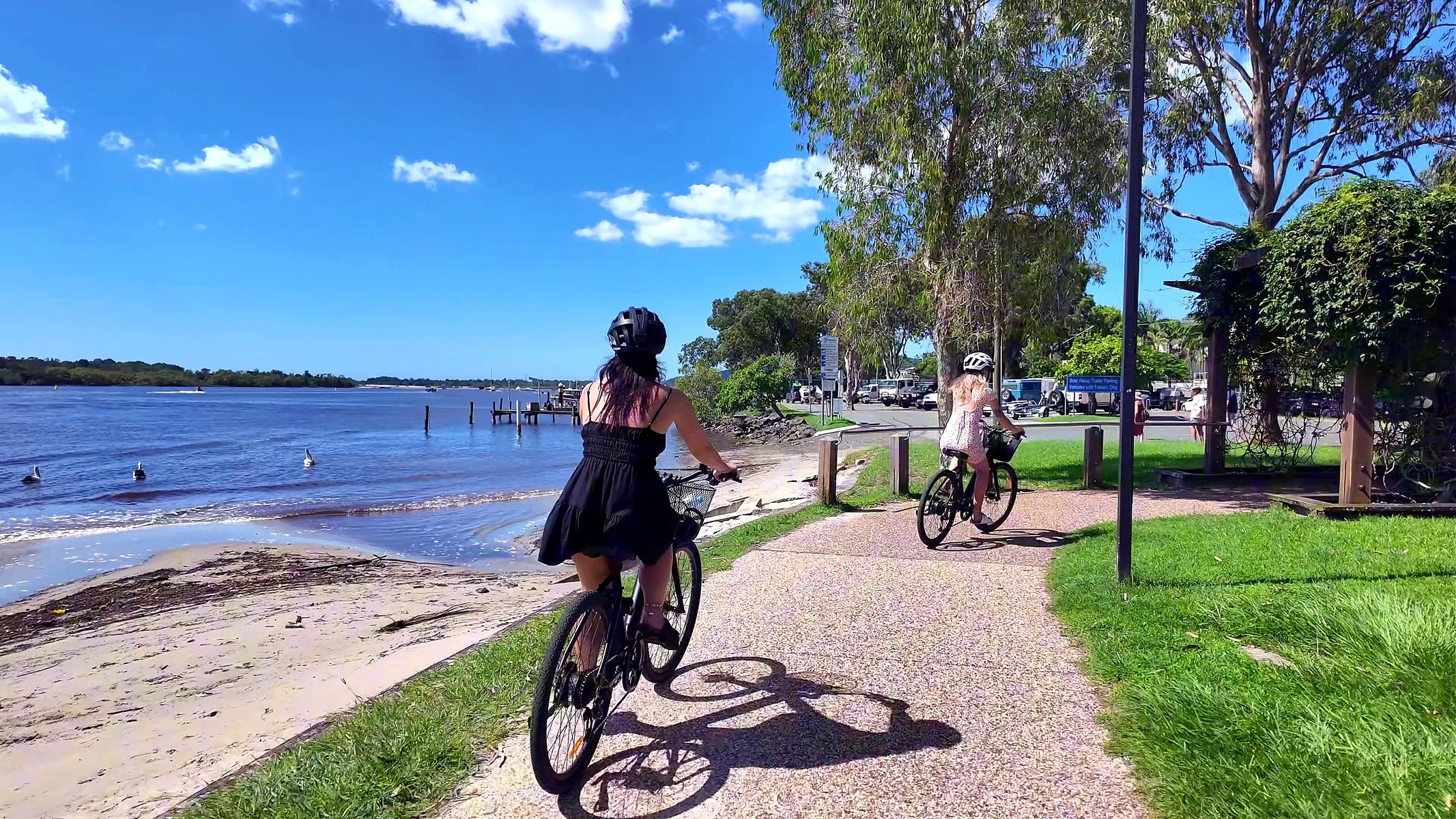
Our rides start and finish in Noosaville, and the first and last kilometres follow the water. From Lake Doonella the paths run along Gympie Terrace and the Noosa River, past Munna Point to Weyba Creek. This is Kabi Kabi Country, where people fished, camped and gathered long before Gympie gold miners built weekend shacks on the riverbank in the 1870s. Until timber bridges opened in 1929, most visitors arrived by boat.
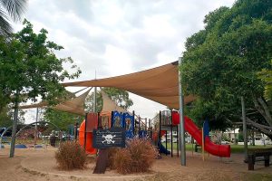
Ride it: The Full Noosa Ride follows this whole stretch of river, and the Pirate Park Kids Ride is the easy family version. More to read: Noosa Sealed Bike Paths.
Lake Doonella
Lake Doonella is a shallow, tidal lake joined to the Noosa River between Tewantin and Noosaville, fringed with mangroves and patches of seagrass. In 1871 the first land sold along the river was 80 acres on its shore, opposite Tewantin, and in 1907 the lake hosted an aquatic sports day. For decades it was the barrier between Tewantin and Gympie Terrace, until a timber bridge opened across its mouth on 19 October 1929, with about 700 cars queued to cross. The lake was declared a fish habitat area in 1983 and is now part of the Noosa River Fish Habitat Area, a nursery for bream, whiting, flathead, mud crabs and prawns. From the path, watch for black swans, pelicans and cormorants, and look down for mangrove roots at low tide.
Gympie Terrace
After gold was found at Gympie in 1867, miners and their families began building simple holiday houses on the riverbank downstream from Tewantin in the 1870s and 1880s. The settlement took the name of its owners’ home town, Gympie Terrace. For nearly sixty years the river was the only way in, until the Lake Doonella bridge opened in 1929. By 1933 about 60 houses and shops lined the Terrace. During the Second World War troops trained in amphibious vehicles on the river and Lake Weyba, and after the war fishing, prawning and boat hire took over the waterfront. The suburb became Noosaville in the early 1920s, but when a renaming of the street was floated in 2009, long-time families pushed back and Gympie Terrace stayed. Road riders on the Noosa Triathlon bike leg race along this same street.
Munna Point
Munna Point, where the river bends at the end of Gympie Terrace, was noted by an early settler as a camping and fishing place and a corroboree ground for Aboriginal people. In 1871 it fell inside a reserve for Aboriginal mission purposes, which was cancelled in 1878; in the early 1900s most Kabi Kabi people were forcibly moved inland to Barambah, now Cherbourg. A public purposes reserve followed in 1884, and holiday camping began around 1929, when the new bridges brought cars. In 1956 part of the reserve was set aside for caravans and camping. When camping ended at Noosa Woods in 1990, Munna Point became the last camping ground on the estuary. In 2009 the park was entered on the Queensland Heritage Register as a good example of the waterside camping reserves that shaped holidays on this coast.
Weyba Bridge
Weyba Creek winds from Lake Weyba, the southern gateway to the Noosa Everglades system, to meet the lower Noosa River. Bridging it has always been a saga. The first, the 61 m Alexandra Bridge, opened in 1886 and was soon ruined by shipworm. A timber pile bridge opened on 19 October 1929, the same day as the Doonella bridge, finally linking Tewantin, Noosaville and Noosa Heads by road. When a concrete bridge replaced it from 1969, locals kept the old one for walkers. It partly collapsed in 1991, and the Friends of the Old Weyba Bridge raised money for the replica you ride today, built in 1995. The creek is part of the Noosa River Fish Habitat Area, its mangroves a nursery for fish, crabs and prawns. Weyba is thought to come from an Aboriginal word for stingray, though some sources suggest flying squirrel.
Area 2 of 8
Noosa Heads and Noosa National Park
Across Weyba Creek the river meets the sea. Hastings Street, Main Beach, the Spit and the headland of Noosa National Park are the Noosa most visitors picture, and they look this way because of a long local push to keep the town low-rise and green. Flat paths, a couple of short steep climbs to the lookouts, and plenty of reasons to stop.
Ride it: The Full Noosa Ride, with optional detours to the Spit, the national park bike racks and Laguna Lookout.
Hastings Street
Hastings Street began as a surveyed village of allotments behind the beach in 1879, and the pioneer Walter Hay was its first landowner, buying three blocks in 1882. For decades the only easy way in was by boat from Tewantin, so it stayed a sleepy holiday spot of boarding houses and a few shops. The road bridges of 1929 changed that, and from the 1930s cafes and guesthouses spread along the beachfront. The street was sealed in the 1950s, and surfing put it on the map in the 1960s. Its low-rise character is no accident: in 1990 the council capped building heights at four storeys across the shire, part of a long local push to keep Noosa low-rise. Nobody is sure where the name came from; one theory points to a Gympie goldfields reef named after the ship Warren Hastings.
Noosa Spit and Noosa Woods
The river mouth has never sat still. The Noosa River once reached the sea near today’s Noosa Woods, and when beachfront building made the entrance unstable, engineers relocated the mouth to the north west in 1978 and built the spit groyne to hold it there. A second groyne followed in 1982. Noosa Woods has its own story. It was once rainforest of brush box, lilly pilly and ash, cleared by council in 1962 for a busy camping ground that families returned to every summer. In 1990 camping was ended and the Woods was replanted as a rainforest recreation area, a decision that sparked protest marches down Hastings Street at the time. Across the water, Noosa Sound was built in the early 1970s on Hays Island, a mangrove island raised with dredged sand. Today the Spit is a favourite for picnics, dogs and shorebird watching.
Noosa Main Beach
Main Beach runs about 1.2 km from the headland to the river mouth and faces almost due north into Laguna Bay, which keeps the swell gentle on most days. A lifesaving reel stood on the sand by 1915, and the surf club traces its first steps to 1928. The beach has always fought the sea: cyclones in 1967 stripped so much sand that residents dumped rocks to protect their homes, a rock wall went in from 1969, and since 2009 a sand recycling system has pumped sand from the river end back to the eastern end. Around the headland, the points made Noosa famous with surfers. Kevin “The Sheik” Freeman was riding them in the 1940s, and a 1963 Surfing World story called the waves the best in the Commonwealth. In 2020 the coast from North Sunshine Beach to the river became the world’s 10th World Surfing Reserve. Each spring the Noosa Triathlon swim leg starts here.
Noosa National Park
The forested headland at the end of Hastings Street is the reason Noosa still looks the way it does. It was set aside as a reserve in 1879, and about 600 acres around the headland were declared a national park in 1939. Back then the park did not even reach the sea. In 1962 Dr Arthur Harrold and friends formed what became the Noosa Parks Association to stop a road being built around the cliffs, and over the following decades the park grew to take in the shoreline, Alexandria Bay and land as far south as Coolum. Today Queensland Parks and Wildlife Service manages about 3,000 ha across several sections. Bikes stop at the racks, but the Coastal Walk carries on past Boiling Pot, Tea Tree Bay and Dolphin Point to Hell’s Gates. Look for koalas in the trees, dolphins and turtles below the cliffs, and humpback whales from June to November.
Halse Lodge
Halse Lodge holds one of the oldest stories in Noosa Heads. The land was taken up in the 1870s and passed to the pioneer Walter Hay in 1881, who built Bayview there, a two storey timber boarding house where early visitors arrived by coach or by boat from Tewantin. It changed hands many times, was largely rebuilt in the 1920s, and was later known as Hillcrest. In 1959 the Anglican Church bought it and named it after Archbishop Reginald Halse, using it for group holidays for nearly thirty years. It was entered on the Queensland Heritage Register in 1997 and still takes guests today, one of only ten state heritage places in Noosa Shire and the only one in Noosa Heads.
Laguna Lookout
The climb up Viewland Drive is short and very steep, so this is where the e-assist earns its keep. At the top, Laguna Lookout opens over the whole lower river: the mouth and Main Beach below, the Noosa River winding north towards Lake Cooroibah, the sand mass of Great Sandy National Park beyond, and to the west the old volcanic plugs of the hinterland, best at sunset. The bay itself was named Laguna Bay by surveyor James Charles Burnett on 25 July 1847. Nobody recorded why. “Laguna” is Spanish for lagoon, and an 1866 newspaper called it “Nusa Bay, or as it is better known, Lagoona Bay”. The walk to the lookout passes grey gums, pink bloodwoods, ironbarks and tallowwoods; keep an eye out for kookaburras, lace monitors and koalas. Between June and November, scan the bay for humpback whales.
Area 3 of 8
Tewantin and the North Shore
Long before Noosa Heads was a resort, Tewantin was the town that mattered: the river port where timber came down the Noosa River to be shipped to Brisbane, and where Gympie families came for their holidays. From here the ferry crosses to the North Shore and the long, wild beach that runs north towards Teewah and Rainbow Beach.
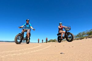
Ride it: the Noosa North Shore Beach Ride crosses on the ferry and rides the beach on fat tyre e-bikes. The Full Noosa Ride and the Pirate Park Kids Ride also pass the old wharves at Noosa Marina. More to read: Noosa Beach Bike Riding.
Tewantin’s old wharves
Tewantin grew up around a timber wharf. In 1870 the Port Master, George Heath, mapped “Nusa Harbour” as a better outlet for timber than the Mary or Maroochy rivers. The town was proclaimed in 1871 and by November 1874 a wharf and goods shed holding 40 tons stood on this bank. Timber came down the river, including from the Mill Point sawmill on Lake Cootharaba, and coastal steamers took timber, fish and oysters to Brisbane. From 1878 Cobb and Co coaches linked the steamers with Gympie. The name Tewantin is usually traced to the Kabi Kabi word dauwadhan, often translated as “dead trees or logs”. The railway to Gympie (1889) took much of the passenger trade, and the steamer Culgoa was wrecked on the Noosa bar in 1891. Tourism took over: the Parkyn family later ran a jetty, boat hire and bait business here, and one of their buildings still stands at today’s Noosa Marina.
Royal Mail Hotel and Parkyn’s Hut
The first Royal Mail Hotel opened quietly in May 1882, built for Ned Murdock, a Cobb and Co coach driver. Under later owners its buggies and coaches met the trains at Cooroy once the railway arrived in 1891, and the hotel became a holiday favourite for Gympie families. In March 1939 the two storey timber hotel was destroyed in a spectacular fire. Its brick replacement, designed by architects Addison and Macdonald for the Queensland Brewery, reopened in 1941 and still carries its original “Royal Mail” lettering; Heritage Noosa calls it a relatively rare mid century corner hotel. At the same intersection stands Parkyn’s Hut, a hardwood miner’s cottage from the Monkland at Gympie, carted to Tewantin by bullock team around 1920. The Parkyn family used it for guests from 1938, and in 2001 it was moved here to open as the Tewantin Heritage and Tourist Information Centre.
Noosa North Shore Ferry
The far bank has its own timber past. In 1872 Abraham Luya bought 84 acres on the North Shore and built a timber depot and wharf, and a small village called Colloy grew around it. By 1880 Dath, Henderson and Co ran a sawmill on the northern bank opposite Tewantin; it closed in 1891. For decades after, the far side was reached only by boat. Noosa Library’s timeline records that Herbert Woods introduced a passenger and vehicle ferry here in 1963, opening the way to the North Shore and the beach run to Teewah. The service is run under contract to Noosa Council. In July 2024 Entrada Travel Group took over from Noosa North Shore Ferries, operators since 1999, bringing new 27 and 12 vehicle ferries and cashless payments. Upstream the river widens into Lake Cooroibah on its way down from the Noosa Everglades system.
Noosa North Shore beach
From the end of Beach Road the sand runs north towards Teewah and, about 60 km on, Rainbow Beach. This is the southern start of the Cooloola beach drive through the Cooloola Recreation Area of Great Sandy National Park, and the beach is also a road: Queensland road rules apply, vehicles need permits, and four wheel drives travel at speed. Ride within about two hours of low tide, on firm sand, and turn back before the tide does. The dunes behind you matter. In January 2026 Noosa Council reported that the North Shore had its highest number of recorded turtle nests that season, from endangered loggerheads and threatened green turtles. A nest can hold around 150 eggs, yet as few as one hatchling in a thousand survives to adulthood. Keep off the dunes, use the marked access tracks, and never ride the beach at night, when lights confuse nesting turtles and hatchlings.
Area 4 of 8
Tewantin National Park and Mt Tinbeerwah
Behind Tewantin the land rises through Tewantin National Park, former state forest now laced with mountain bike trails, to the old volcanic plug of Mt Tinbeerwah. Gyndier Drive, the old range road, links them, and every Noosa Triathlon racer knows its climb.
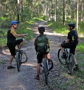
Ride it: the Mt Tinbeerwah Ride climbs Gyndier Drive to the summit, and the Wooroi & Wetlands and Tewantin MTB Trails rides take mountain bikes onto the Wooroi trails. More to read: Mountain Biking Noosa.
Tewantin National Park, Wooroi
Tewantin National Park protects rainforest, open eucalypt forest and the last wallum remnants between Noosa and Cooroy, on the traditional Country of the Kabi Kabi and Gubbi Gubbi peoples. Much of it was once State Forest 959. After years of lobbying by the Noosa Parks Association the forest was declared national park in 2010, and land from the Yurol and Ringtail state forests was added from 2011. Its forestry past lingers: a heritage site along Gyndier Drive holds remains of an old forestry camp, including references to Chinese workers. The Wooroi day-use area, shaded by coastal she-oaks and bloodwoods, is a historic picnic spot and the trailhead for eleven mountain bike trails, from the easy Hovea loop to the one way Turn 10, managed by Queensland Parks and Wildlife Service with the Noosa Trailblazers Mountain Bike Club. Listen for eastern whipbirds, and watch for swamp wallabies, echidnas and glossy black cockatoos.
Gyndier Drive (Garmin Hill) and the Noosa Triathlon
Gyndier Drive follows the old Cooroy to Tewantin range road; Noosa Library holds photos of the “Cooroy-Tewantin Range Road (Gyndier Drive)” being built in the early twentieth century. The Cooroy to Tewantin road opened in December 1928 as the first main road built in Noosa Shire. Today Gyndier is closed to motor traffic, with bollards at each end, and climbs about 3 km through the forest to Sunrise Road. Two events made it famous. Since 1998 the Noosa Beach Classic Car Club has run the Noosa Hill Climb here, a not for profit motorsport event on a 1.5 km closed course with 14 tight corners.
The Noosa Triathlon began in October 1983, the idea of former Olympian Dave Power and all-round sportsman Joe Gilbert with the Noosa Heads Lions Club. They had planned a marathon but could not find enough sealed road, so they settled on a triathlon. About 180 athletes started; helmets were optional, wetsuits were banned and some cyclists got lost. Under Garth Prowd it grew into a five day multisport festival with more than 13,000 competitors, and it is billed as the largest Olympic distance triathlon in the world. The 40 km bike leg runs from Noosa along the river to Gyndier Drive, the quiet forest climb racers call Garmin Hill, about 10 km in. After the top, the course turns onto Cooroy Noosa Road for an out and back before a fast descent home.
On race day the climb carries a King of the Mountain prize. The rest of the year it is a quiet forest road, so watch for walkers.
Mt Tinbeerwah
Mt Tinbeerwah rises 265 m above sea level, a volcanic plug formed millions of years ago. The name is said to mean “place of grasstrees” or “high hill climbing up”; sources differ. From the carpark a 1 km return track, about 45 minutes, leads first to a lower lookout with coastal views, reachable by wheelchair and pram, then climbs to the summit. The summit lookout was once a forestry fire observation tower, and Noosa Library photos show daytrippers returning to their bus from it in 1952. The 360 degree view takes in the coast and hinterland, and on clear days the volcanic plugs of the Glass House Mountains to the south. The rocky summit carries montane heath and a rare mint bush known as Prostanthera sp. (Mt Tinbeerwah), listed as vulnerable. Climbers use the cliffs beside the track; stay behind the safety fence. There are toilets at the day-use area but no drinking water.
Area 5 of 8
Lake Weyba
Lake Weyba is the quiet, shallow southern end of the Noosa Everglades system, its southern gateway. The eastern shore is national park and the western shore has changed little, so this is one of the most natural stretches of water our rides reach.
Ride it: the Lake Weyba and Tewantin Forest Loop follows the western shore, and The Full Noosa Ride has an optional detour along Lake Weyba Drive.
Lake Weyba
Lake Weyba is the southern gateway to the Noosa Everglades system: a large, shallow, tidal saltwater lake fringed by mangroves, saltpans and open forest, and linked to the lower Noosa River by Weyba Creek. It is listed in the Directory of Important Wetlands in Australia and is an important fish breeding habitat. The name, once spelt Weiba, is often said to come from a Gubbi Gubbi word for stingray; some sources suggest flying squirrel instead, and both feathertail gliders and stingrays are found here. For the Kabi Kabi people the lake was a rich source of food, and shell middens and scarred trees remain around its shores. Noosa’s first professional fisherman, Joseph Keyser, settled on the north-west shore and is remembered for wheeling smoked mullet to the Gympie goldfields in a barrow. Today the whole eastern shore is national park.
Lake Weyba western shore
The lakeside path at Weyba Downs follows the western shore of Lake Weyba, the southern end of the Noosa Everglades system. The catchment was never fertile enough for farming, so much of the lake still looks as it did to its Kabi Kabi custodians, whose shell middens, scarred trees and a large stone fish trap at the southern end remain. In the 1890s, under the Co-operative Communities Land Settlement Act, 59 unemployed Brisbane men and their families, the Woolloongabba Exemplars, settled the western side. They sold fish to Gympie and Brisbane, but their hand dug wells dried up and the commune had collapsed by 1896. Eumarella Road takes its name from the Tainsh family property at Rocky Point, a local picnic spot into the 1950s. South of the lake, Murdering Creek is thought to mark a massacre of Aboriginal people in the 1860s; historians have not settled the date or how many died.
Area 6 of 8
The Coast to Coolum
South of Noosa National Park the land flattens into a long run of surf beaches, wallum heath and low volcanic hills, threaded together by David Low Way. This is Kabi Kabi (Gubbi Gubbi) Country; around Coolum it was home to the Inabara (Yinneburra) clan of the Undanbi people. For most of the last century the beaches were hard to reach: Coolum was a cane and dairy district reached from Yandina, and the coast road only opened in stages from 1960. The villages you ride through, from Sunrise Beach to Mudjimba, grew up beside it, and each has a surf club story, a name story and a view worth stopping for.
Ride it: the Noosa Surf Beaches Ride runs from Sunshine Beach to Peregian, and the Coolum Coast Ride takes a road bike down David Low Way to Coolum and Mudjimba.
David Low Way
Until 1960 there was no road along this coast. Coolum was reached from Yandina, on a road that was often partly under water where it crossed a swamp. David Low, born in Yandina in 1911, was Country Party member for Cooroora from 1947 to 1974 and chairman of Maroochy Shire from 1952 to 1967, and he championed both a coastal road and an airport. He turned the first sod on 13 July 1959. Premier Frank Nicklin opened the first section, Sunshine Beach to Peregian, on 2 April 1960; developer T M Burke built the northern end in return for development rights at Peregian and Sunrise Beach. Coolum to Peregian followed in May 1961, and on 12 August 1961 the Scenic Coastal Highway was officially opened at Mudjimba Beach, the same day Maroochy Airport was opened at Marcoola. Critics called the airport a “white elephant” and Low’s “big mistake”. Today the road runs 36 km from Maroochydore to Noosa Heads.
Sunrise Beach and Sunshine Beach
The first selectors here proposed a “Town of Alexandra” around 1890, and for decades locals simply called this stretch Coolum Beach. In 1925 developer T M Burke visited Tewantin and was struck by the coast. His company gained the land in return for building bridges over Lake Doonella and Weyba Creek, and in October 1929 launched “Noosa Beach Estate Golden Beach” with a lifesaving carnival reported around the country. The Depression slowed sales. After the war, local lifesavers restarting their club learned that a Caloundra club already used the name Golden Beach, so they proposed Sunshine Beach, adopted officially in July 1949. Sunrise Beach came later: Burke’s local manager Peter Sharpe named the land west of the new road “Sunrise Estate”, and it was released in stages from 1970 into the early 2000s.
Castaways Beach and Marcus Beach
When the coast road opened in 1960, three small bridges carried it over Burgess Creek, Castaways Creek and one more creek towards Marcus Beach. The first development on this section of coast was the Castaway Motel, owned by Peter and Marea Brown, and the beach took its name. Castaways Estate, on the western side, was given nautical street names such as Wavecrest Drive, and today it is houses only, with no units. Marcus Beach honours Marcus Burke, who became chairman of T M Burke Pty Ltd after his father died. Its beachfront lots were sold from the 1970s, the western side in the 1980s, with timber-themed street names like Redwood. Noosa Council fought to keep the Marcus High Dunes undeveloped; the developer was compensated and the dunes are now part of Noosa National Park.
Peregian Beach
Peregian is thought to come from a First Nations word for emu, and Sunshine Coast place name records suggest emus were once plentiful in the district. Until the late 1950s this was Crown land. When the coast road came through, developer T M Burke and Co, working with Maroochy councillor David Low, took a 20 year lease with development rights in return for building it. The first house was built on Pelican Street in 1960 and is still there, and the first 120 lots were laid out around it. With no town plan until 1973, streets simply followed the easiest line. A community swimming pool opened in the middle of the shopping square in 1964. The surf club, founded in 1962, has had a rollercoaster life: closed after a cyclone in 1974, revived in 1984, folded in 2014 and back on patrol since 2022.
Emu Mountain and the Peregian heath
Between Peregian and Coolum the road crosses open wallum, the low, sandy heath that once covered much of this coast. Rising out of it is Emu Mountain, also known as Mount Peregian, an unusual rocky knoll of rhyolite left from a once larger volcanic mass. A short, steep walk (1.1 km return, about 45 minutes to an hour) climbs through montane and coastal heath to an old trig point with views from Noosa to Maroochydore, the Glass House Mountains and Mount Tuchekoi, and humpback whales offshore from June to November. The mountain shares its name with the endangered Mt Emu she-oak, a wiry shrub found only along a 55 km strip between Beerburrum and Noosa. The surrounding heath is home to the threatened ground parrot and wallum froglet, and the walk is known for its wildflowers.
Coolum Beach
Coolum is thought to come from gulum or kulum, often translated as blunt or headless, after the flat top of Mount Coolum. For its first decades this was cane and dairy country; a cane tramway reached Coolum in 1923 and an estate sale that year promised bathing sheds, golf links and tobogganing on the hill. The surf club began in 1919, when local settler Jack Morgan took up a challenge to “do something about lifesaving” on his beach. It nearly folded after a Boxing Day triple drowning in 1948, and was rebuilt by its last two active members. Parks along the foreshore honour Edward Tickle, who planted the foreshore trees, and club stalwart Norrie Job. Up the hill, Low’s Lookout is named after road gang boss Ted Low, David Low’s brother. World tour surfer and Olympian Julian Wilson surfed here as a grommet.
Yaroomba and Point Arkwright
The rocky headland of Point Arkwright is where the base of Mount Coolum meets the Pacific. Its name appears to honour Sir Richard Arkwright, inventor of cotton spinning machinery, paired with Point Cartwright further south, named after another textile inventor. Yaroomba, said to mean “surf on the beach”, began in 1953 as an estate called Coronation Beach, named for the Queen’s coronation, and took its present name in 1961. Much of it is taken up by the resort and golf course long known as the Hyatt Regency, later home to the Australian PGA Championship and, under Clive Palmer, a park of lifesize dinosaurs. South again, Marcoola is a coined name built from MARoochydore and COOlum. Its surf club began in 1969 with a nippers group and caused a stir in 1979 by training girls before women could join surf clubs.
Mount Coolum
At 208 m, Mount Coolum is the landmark of this coast, a dome of volcanic rock whose base runs into the sea at Point Arkwright. Kabi Kabi tradition tells of the warrior Coolum and his love for Maroochy, who was stolen by Ninderry. Ninderry struck off Coolum’s head, which rolled into the ocean to become Mudjimba Island; Coolum’s body turned to stone as this headless mountain, and Maroochy’s tears became the Maroochy River. In the 1980s the mountain was a development target until a community campaign saved it. It became a national park in 1990, with coastal sections at Marcoola added in 2001. Its summit montane heath is found on the Sunshine Coast only here and on a few Glass House peaks, and about half the region’s plant species grow in the park.
Mudjimba Beach and Old Woman Island
Mudjimba takes its name from the midyim, a coastal shrub with sweet white berries; the name is said to mean “place of midyim”. The island holds two Kabi Kabi stories. In one, it is the head of the warrior Coolum, struck off by Ninderry. In another, two women crossed on a bunya pine log that then drifted away, leaving them stranded, living on midyim berries, fish and shellfish. As they aged, people on the mainland could see only one of them at a time, so it became Old Woman Island. The island, under two hectares, is part of Maroochy River Conservation Park and a nesting site for wedge-tailed shearwaters, with about 2,700 burrows counted in the late 1990s. Surfers rate its break as one for experts only, reached by boat. On shore, Mudjimba was first developed as the Surfrider Estate, and its residents formed an association in 1960.
Twin Waters and the Maroochy River
Twin Waters sits between the ocean and the Maroochy River, on land that was once part of Mudjimba and a coastal locality called Ningerry Beach. It is largely a canal estate with a golf course designed by Peter Thomson and Mike Wolveridge, opened around 1990 to 1991. What makes it special for riders is the edge: most of the river frontage is protected in the Maroochy River Conservation Park, set aside in 1992. The lower river’s sandbanks and mudflats are high value shorebird habitat, where Council surveys have recorded the critically endangered far eastern curlew, bar-tailed godwits, whimbrels and pied oystercatchers. Low tide is the time to look. In the Kabi Kabi story of Coolum and Ninderry, this river is the tears Maroochy wept for her lost love.
Area 7 of 8
Lake Macdonald, Cooroy and the Forests
West of Tewantin the road and gravel rides climb into the hinterland: the Yurol and Ringtail forests being returned to national park, the coach road Walter Hay cut from the Gympie goldfields in 1870, Lake Macdonald, which holds Noosa’s drinking water, and Cooroy, a timber and dairy town that grew up around the railway.
Ride it: the Ringtail Loop and Yurol Forest Loop are our gravel rides through the forests, the Lakes Ride with Garmin Hill passes the back of Lake Macdonald, and the Pomona Loop rolls through Cooroy. More to read: Gravel Bike Riding Noosa.
Yurol and Ringtail forests
Pomona was once a centre of forestry, and the Yurol and Ringtail state forests on its eastern side were mostly given over to pine plantation. When the state’s plantation forests were privatised, the Noosa Parks Association went to the plantation owner and negotiated a price, and the state, Noosa Council and the association shared the cost of the Yurol and Ringtail acquisition, delivered in 2018. In 2022 the Queensland Government announced that more than 2,400 hectares of former state forest and plantation would join Tewantin National Park once the final pine and hardwood harvest was finished, with revegetation to follow. The Kabi Kabi Peoples are working with Queensland Parks and Wildlife Service on managing the park and on replanting. Drone surveys have found koalas here, and the forest is habitat for threatened species such as the giant barred frog and Richmond birdwing butterfly.
Ringtail Creek Road and the 1870 Shortcut
After gold was found at Gympie in 1867, the only coach road ran south to Brisbane, a slow trip with bushrangers waiting on the way back. Walter Hay, whose gravestone calls him the father of Noosa, was engaged to cut a direct route from the goldfields to a new port on the lower Noosa River. He rode into Tewantin at the end of blazing the Shortcut just before Christmas 1870. The route passed through Cooran and the Ringtail scrub, and it was soon a Cobb and Co coach route, until rail from Cooran and later Cooroy replaced it. Local historian Phil Jarratt traced the old coach route along this road; past the gravel it becomes Trail 4 of the Noosa Trail Network, whose rough Alt 4 section follows the original 1870 road.
Lake Macdonald
Lake Macdonald is the reservoir behind Six Mile Creek Dam, built in 1965 and raised by 3.6 metres in 1980. It holds about 8,018 megalitres for South East Queensland’s drinking water and covers around 260 hectares, and it is named in memory of former Noosa Shire Council chairman Ian MacDonald. Seqwater is upgrading the dam, with a new spillway and rebuilt embankments, and the water level has been lowered while the work goes on. The lake is stocked with Mary River cod, bass, yellowbelly and saratoga, and a hatchery on its banks has bred the endangered cod for release into the Mary River catchment. Paddlers and birdwatchers love it. Along Lake Macdonald Drive are the Noosa Botanic Gardens, opened in 1990, with eight hectares of gardens, a bush chapel and a Greek style amphitheatre.
Cooroy
Cooroy takes its name from the nearby mountain, originally Coorooey, from the Kabi Kabi word for possum. Timber came first: by 1885 sawmillers Dath, Henderson and Co held 2046 hectares here, and the Fenwick brothers and Robert Morrish opened a sawmill in 1908 that ran until 2000. The railway arrived in 1891, and the timber station and goods shed are now heritage listed. As the land was cleared, dairying grew. The Wide Bay Co-operative Dairy Association opened a butter factory on Maple Street in 1915, replaced by the current brick building in 1930. It closed in 1975, was bought by Noosa Council in 1991 and became the Butter Factory Arts Centre in 2005. Nearby, the Lower Mill site keeps a heritage listed timber drying kiln from 1956. Maple Street’s cafes make Cooroy a classic coffee stop.
Area 8 of 8
Pomona, Kin Kin and the Lakes
Our longest road loop reaches the northern hinterland. Pomona grew up around the railway and was Noosa Shire’s first seat; over the range at Pinbarren lies Kin Kin, and to the east, Boreen Point on Lake Cootharaba, the largest lake in the Noosa Everglades system. Names like Cooroora and Cootharaba come from the Kabi Kabi language.
Ride it: the Pomona Loop takes in Pomona, the Pinbarren range and Kin Kin, and the Lakes Ride with Garmin Hill reaches Boreen Point. More to read: Three Days, Two Nights in the Noosa Hinterland.
Pomona
Pomona began as a railway siding when the North Coast line opened through here in 1891. Timber getters cleared the land first; dairying, sugar cane and fruit growing followed. Railway and postal staff kept muddling Cooran, Cooroora and Cooroy, so the siding became Pinbarren, and in 1900 locals chose Pomona, after the Roman goddess of fruit. When Noosa Shire was created in 1910, Pomona was its largest town and became its administrative centre. The 1911 council chambers on Factory Street now house the Noosa Shire Museum; the council moved to Tewantin in 1980. Factory Street also keeps the former butter factory of 1919. The original station buildings closed in 1991 and were moved across the tracks in 2000 to become the volunteer run Pomona Railway Station Gallery, opened in 2001.
Majestic Theatre
Built in 1921 as a social hall with shops attached, the Majestic was soon showing pictures, and Pomona’s first talkie screened here on 28 April 1931. Ron and Mandy West bought it in 1974. In 1987 Ron screened the 1926 Rudolph Valentino film The Son of the Sheik for a group of travel agents, improvising the music on his restored Wurlitzer organ, and within months the Wests decided to show only silent films. The Majestic has since been promoted as the oldest authentic silent movie theatre in the world and Queensland’s longest continuously operating picture theatre. It was entered on the Queensland Heritage Register in 2009. Today the volunteer group Pomona Arts Inc owns and runs it, and its 1937 Compton organ, restored over six and a half years, was relaunched in 2019.
Pomona Memorial Forest
On the site of the original Pinbarren State School, Pomona’s school forestry club planted a memorial forest during the Second World War to honour local servicemen. A 1946 newspaper report counted 2,400 timber trees, including 1,725 hoop pines and 158 flooded gums, and Monument Australia lists hoop and kauri pines, Pinus taeda, silky oak and flooded gum. A plaque records a rededication ceremony on Sunday 22 October 1955, at the golden jubilee of the Pomona secondary department, as a joint project with the Cooroy Pomona RSL sub-branch. From here the Pomona Loop keeps climbing over the range at Pinbarren, the high point of the ride, before dropping into Kin Kin.
Kin Kin
Kin Kin’s name has long been debated. The Queensland Government records it as reportedly coming from a Kabi word, kauin kauin, indicating the red soil drained by Kin Kin Creek, while many locals prefer “plenty of black ants”, a story you’ll see in the ant sculpture outside the general store. Timber getters worked the ranges from the late 1870s, floating logs down Kin Kin Creek to the sawmill on Lake Cootharaba. In 1905 the Lands Department opened 6,000 acres here for selection, and bananas and dairy followed; the Kin Kin Dairy Company ran from 1914 to 1937. The two storey hotel, designed by Cooroy architect William Fenwick, opened in November 1915. It lost its roof and verandahs in the 1971 tornado, took about three metres of floodwater in April 2009, and reopened in late 2023 after a long restoration. Main Street also keeps the old post office, bank and School of Arts.
Boreen Point and Lake Cootharaba
Lake Cootharaba is the biggest lake on the Noosa River, roughly 10 kilometres long, about 25 kilometres around and on average only about a metre and a half deep. The river enters from the north through the Noosa Everglades system, often described as one of only two everglades in the world, and leaves to the south towards Noosa Heads. Kin Kin Creek feeds the top of the lake. The Queensland Government records several possible meanings for Cootharaba, including the Indigenous name for the lake, a place where wood for notched or studded clubs could be found. In 1869 a timber company, McGhie, Luya and Co, took up land at Mill Point, a few kilometres north of here, and built the Cootharaba Sawmills, later adding a tramway to haul cedar logs from the hinterland. The mill closed in 1892. Boreen Point grew later; its estate blocks went to auction in 1933, and today it hosts sailing regattas.
The Apollonian Hotel
The Apollonian is a gold rush pub that moved to the lake. It was built in Gympie around 1868 as a music hall hotel by Robert “Billy” Barlow, a well known monologue entertainer, a year after James Nash’s gold find turned Gympie into a boom town. After several owners it closed in 1951. In the late 1980s the building was taken down, carried to Boreen Point in four pieces and put back together, reopening as a hotel. Heritage Noosa describes it as one of the last surviving timber music hall hotels of its era, with wide verandahs under a broad pyramid roof. It is a neat link between the Gympie goldfields and Noosa.
Sources
Where These Stories Come From
Every fact here was checked against the sources below, mostly Queensland Government, Noosa Council and Noosa Library records. If you know more about any of these places, or spot something we have wrong, please tell us at the shop.
Main sources: Heritage Noosa, Noosa Library local history, Queensland Places, Queensland Parks, Queensland Heritage Register, Sunshine Coast Council heritage, Noosa Parks Association, The Noosa Everglades, and the local history columns in Noosa Today.
Plan your ride
Ready to See It for Yourself?
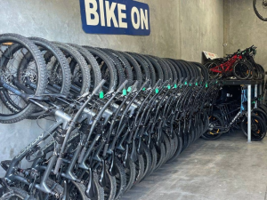
Hire a bike, pick a self-guided ride, and the Ride Guide will tell you these stories as you go.